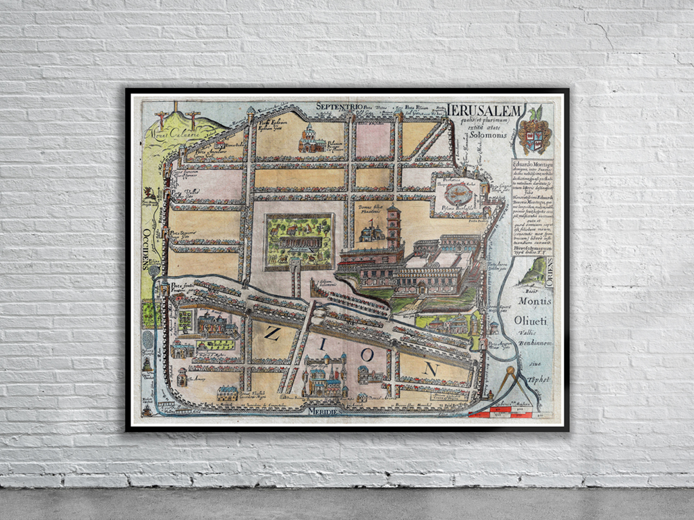
Fuller’s 1650 map of Jerusalem depicts the old walled city of Jerusalem during the reign of the Biblical King Solomon, ca. 961-922 BC. Shown on the map are the Mount of Olives (Montis Oliueti), the Dragon Well, the Fullers Field, the King’s Garden. Despite purportedly being a map of Solomon’s Jerusalem (i.e. before Christ), the map also depicts the Crucifixion on Calvary. Stunning Full Colour Reproduction using the Most Advanced Technology Available Printed on Museum Matte Archival Paper 310gm Unique Conversation Piece for your Home or Business Frame not included